A place on earth so unlike anywhere else that it has been used to test equipment intended for use on Mars. The Dry Valleys region of Antarctica is one of the world's most extreme deserts, but that's only the start of its peculiarities.
Dry Valleys Antarctica
Victoria Land, aka McMurdo Dry
Valleys
Where are the Dry Valleys in Antarctica? How big are they?
The Dry Valleys are a very unusual part of Antarctica, they exist due to the positioning of the Transantarctic Mountain Range which force air flowing over them upwards so they lose their moisture, the valleys therefore are in a precipitation shadow (snow and rain doesn't fall). The mountains also prevent the flow of ice down the valleys from the East Antarctic Ice Sheet and finally, strong katabatic winds of up to 320km/h (200mph) blowing down from the interior along with the low humidity causes the ice from the glaciers that do discharge into the valleys to evaporate. They are one of the most extreme desert climates anywhere on earth, a cold desert where the mean annual temperature is between -14C and -30C depending on the site, windier sites are less cold.
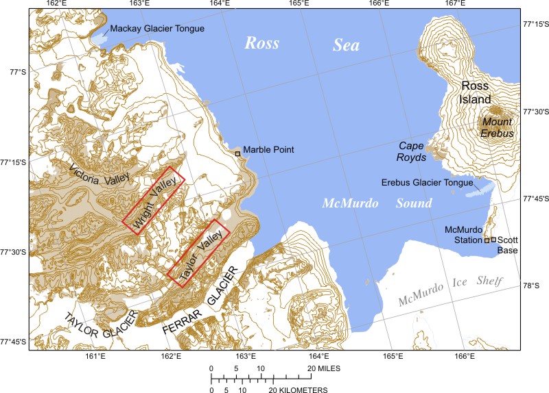
They cover an area of around 4,800 square kilometers and being around 97 kilometers from McMurdo Station, they have been the source of much study for many years now due to a range of phenomena there.
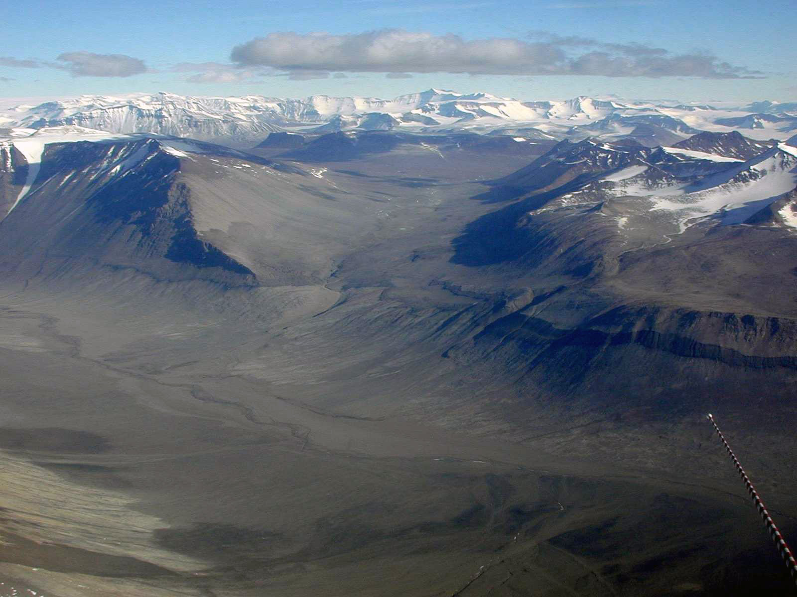
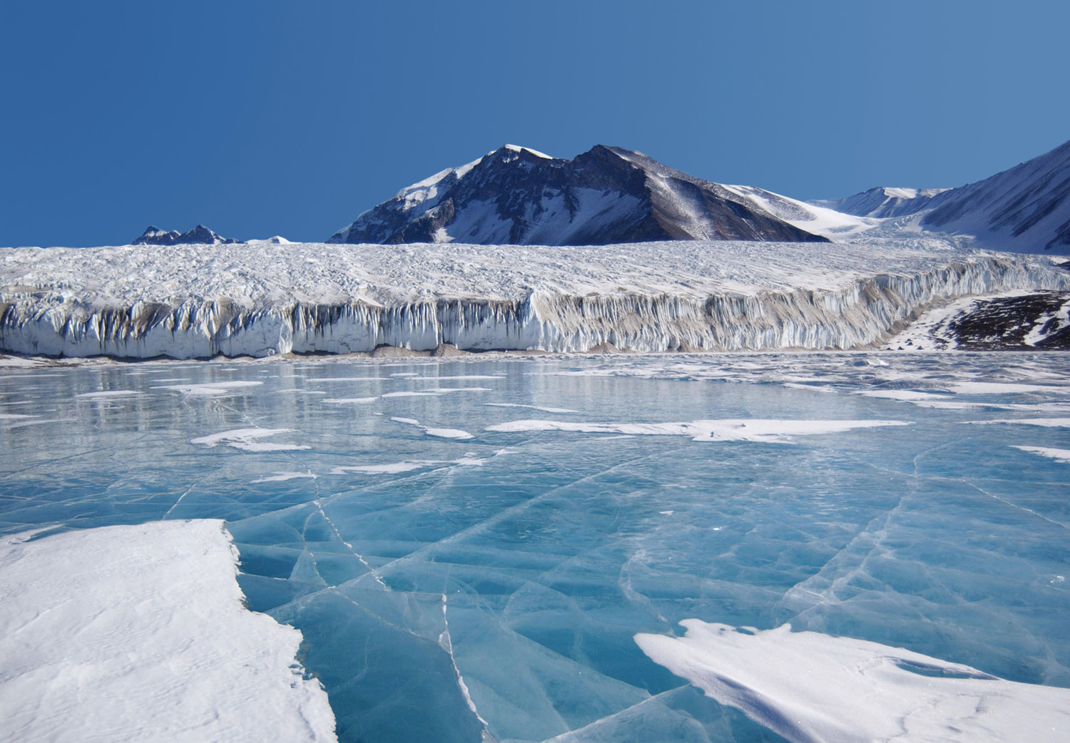
Bull Pass, above, in the Dry Valleys. The temperature in the ice and snow-free area is little or no different to the adjacent ice-covered regions, the local geography accounts for the absence of ice.
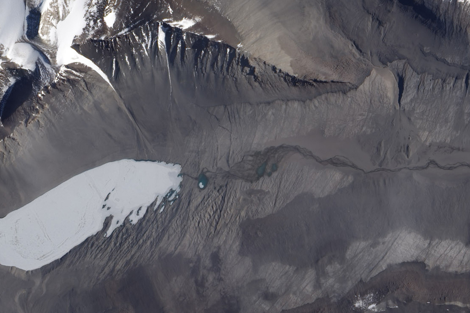
Map below showing some of the features of the Dry Valleys, Bull Pass is approximately central, the Ross Sea is to the top right, the Antarctic interior at bottom left. Map area covered approx. 70 x 75km.
When were the Dry Valleys Discovered?
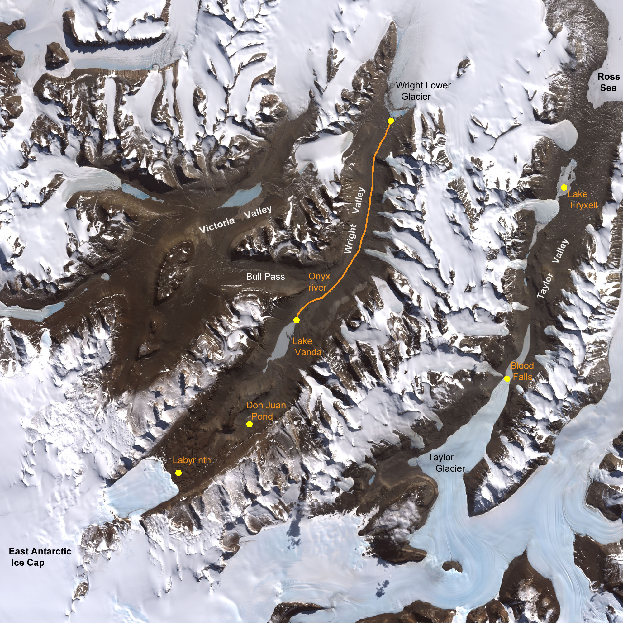
There are three large valleys, Taylor Valley, Wright Valley and Victoria Valley. Taylor Valley was first discovered during Scott's Discovery Expedition in 1901-1904, it was then surveyed in more detail by Griffith Taylor during Scott's later Terra Nova Expedition in 1910-1913 after whom it was named. The valley is hemmed in by tall mountain peaks and no further exploration of the surroundings was made at that time. It wasn't until the 1950's that further valleys and the extent of them was discovered from aerial photographs taken.
There is a lake in Taylor Valley that was officially named after Lake Chad in Africa which in the local language means a large expanse of water or a lake. The actual story of how it got its name says that when the party from Scott's 1910-1913 expedition camped nearby, they took what they assumed was pure drinking water from this lake to be afflicted by dreadful diarrhoea which resulted in the usage of large amounts of toilet paper. The brand name of this paper was "Chad" and so the name was given to the lake. I had assumed this was something of a myth until it was confirmed by Ray Hoare - below.
The lake has now been renamed Lake Hoare.
Received by email from Ray Hoare.

I was on the University expedition that worked out the naming misunderstanding, and we convinced the National Geographic board of It. They named the large lake, previously Chad To Lake Hoare, after me. My expeditions leader wanted them to name one end of that Lake House, after our chemist, and the other Lake Hoare, but for some reason that was unacceptable.
Here is justification for the toilet paper claim. We
thought it was Epsom Salts, since we found lots of Magnesium
in the water. And you have to read Taylor's journal
carefully to see what he is obliquely saying.
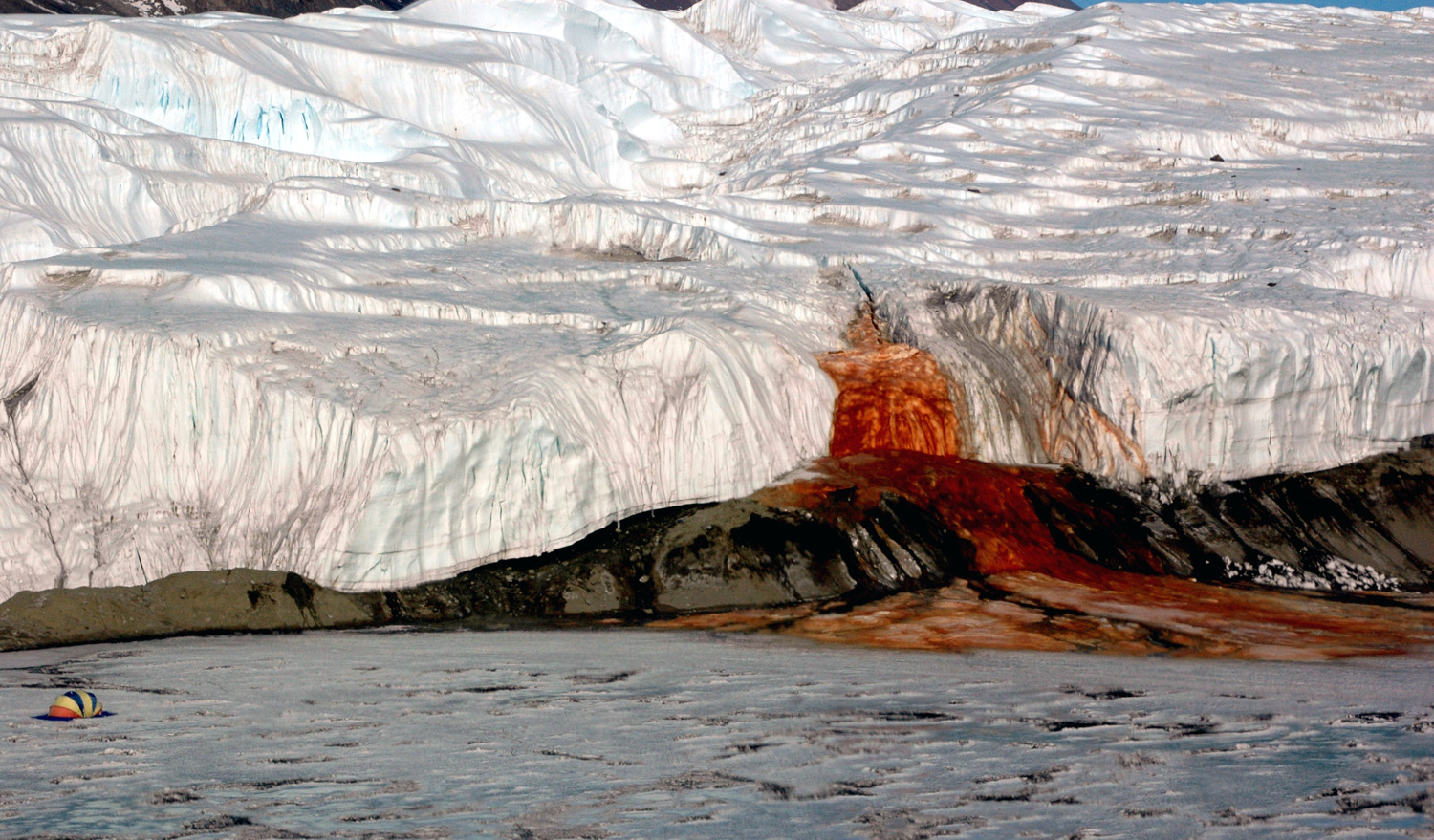
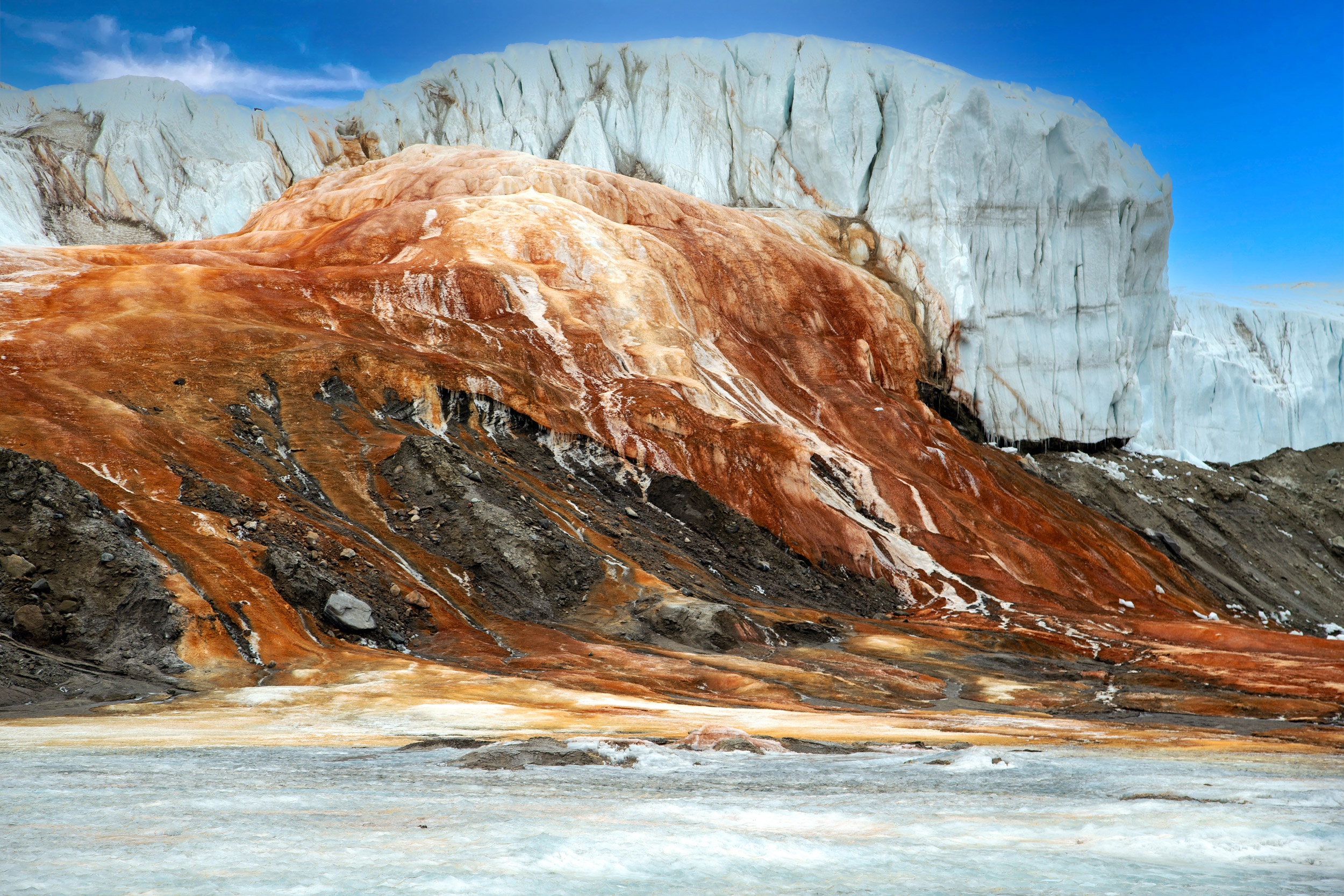
Blood Falls
"Blood Falls" was first discovered by Griffith Taylor on Scott's Terra Nova expedition in 1911. As well as being striking in appearance, Blood Falls (picture below) has an unusual cause. The reddish-brown colouration is due to iron oxides and not algae as was originally thought. These iron compounds come from a sub-glacial lake under the Taylor Glacier where the unusual chemical profile of the lake water allows chemoautotrophic bacteria to survive without any sunlight or input of organic molecules from the outside.
 This outpouring
is a salty solution containing dissolved iron
This outpouring
is a salty solution containing dissolved iron
rather
than being red coloured algae as once thought.
These bacteria take abundant Iron II (Fe2+) and sulfate (SO4-) ions in the lake that come from the underlying bedrock and oxidize them to Iron III ions (Fe3+) releasing energy in the process. This energy is used by the bacteria to synthesize complex organic molecules from simple ones in a manner similar to the way that plants use sunlight in photosynthesis. The large very salty lake beneath the Taylor Glacier occasionally overflows due to water moving in at the back, this causes Blood Falls to flow. It is the only place on earth where there is a known surface manifestation of a deep very salty lake which harbours such microbial life.
It is thought that this locked-away simple bacterial ecosystem and others like it that do not need to derive energy from sunlight may indicate where we might similar ecosystems elsewhere in the solar system such as on Mars or ice covered moons such as Europa (a moon of Jupiter). It shows that subsurface liquid water can exist overlaid by thick ice which protects the water and anything in it from harmful high surface levels of ultraviolet light and cosmic rays, so is able to support life.
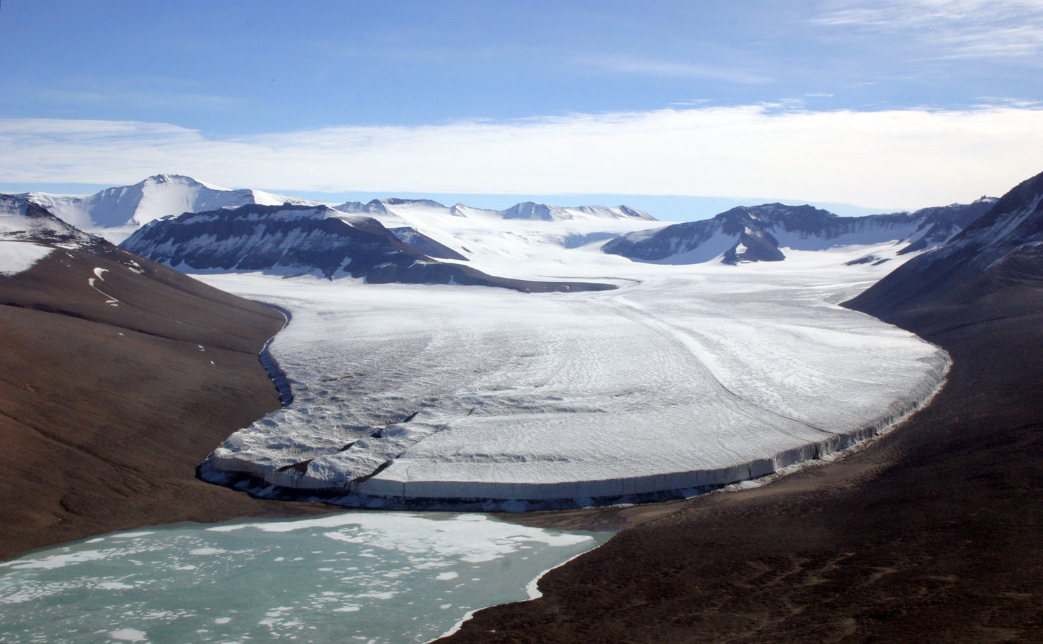
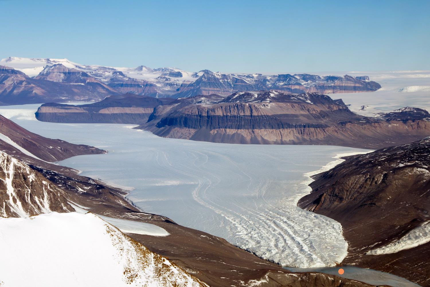 A wider view of the Taylor
Glacier, Blood Falls is just above the orange dot.
A wider view of the Taylor
Glacier, Blood Falls is just above the orange dot.
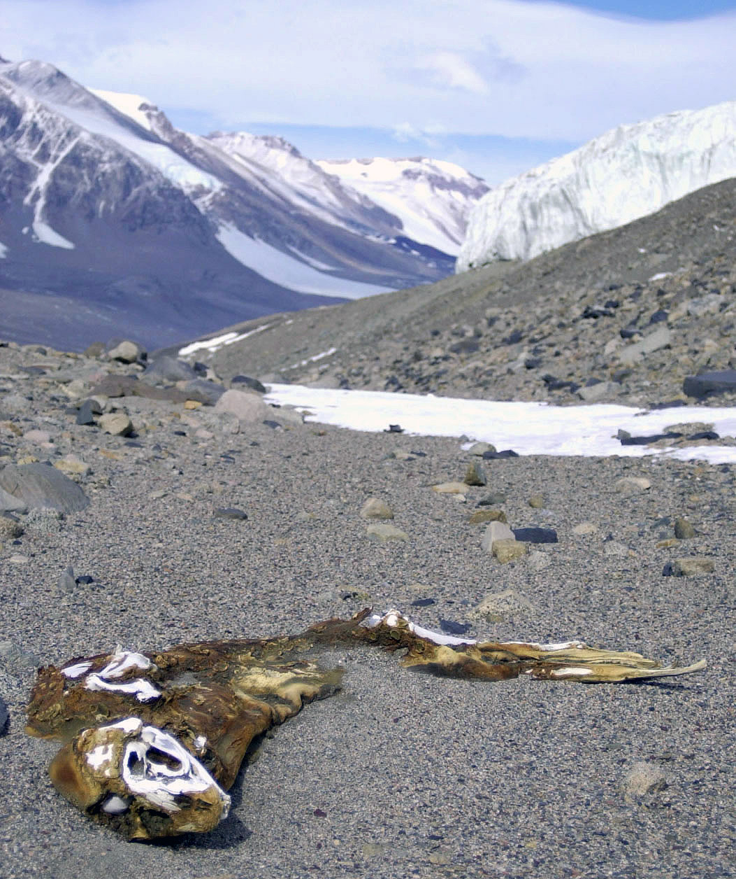
Mummified Seals
One of the Dry Valleys oddities are that they have mummified seals many miles from the sea. They are usually Crabeater and Weddell seals which have been found up to 40 miles from the sea and at altitudes of up to 5,000 feet. These corpses have been carbon dated and found to often be hundreds of years old with the oldest 2600 years.
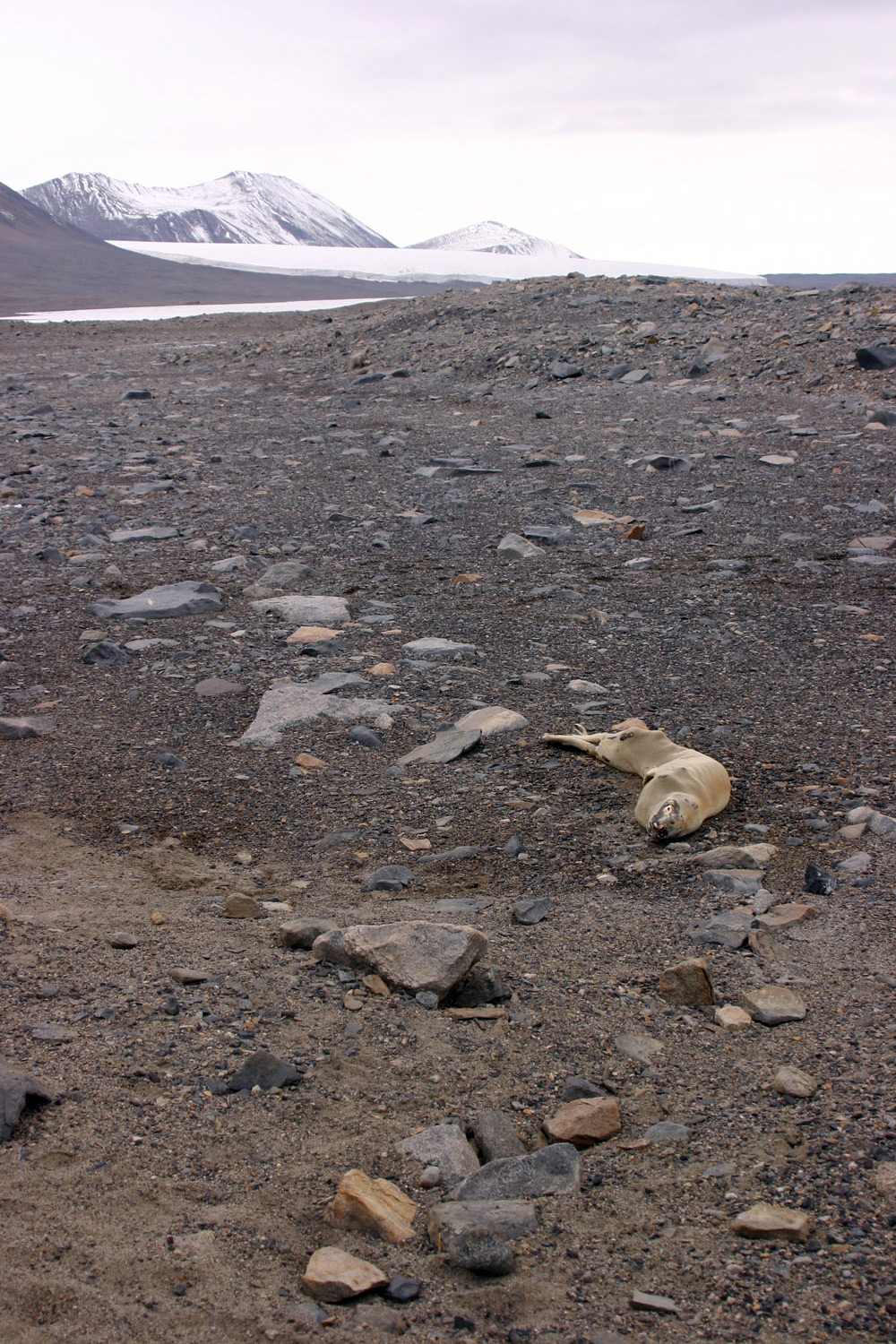
A mummified seal in the Dry Valleys, this may be hundreds of years old.
An older Dry Valley mummified seal in an advanced state of disintegration.
They often seem to be much more recent than this. Cold drying winds desiccate the carcass quickly and lead to mummification, a lack of carrion feeders and decay mean that there is only wind blown dust and sand to make the carcass break down along with the effects of freeze thaw and the summer sun. The newer ones (a mere hundred years or so old) are very well preserved, but as they age they start to disintegrate until only scattered and slowly eroding bones are left. Sometimes they end up in lakes which may be seasonally melted which speeds up their breakdown.
There are places where there are several of these carcasses are found in the same position giving the impression that they arrived together, though closer investigation has shown that they have simply been funnelled by the landscape to the same position and in fact differ in date of arrival and death by decades.
No-one is exactly sure how or why these seals end up in the middle of the Dry Valleys in such horribly inhospitable conditions and after what must have been such a dreadful journey to get there, but there are some indications.
Most of the seals examined are juveniles, less than a year old, it is thought that they simply take the wrong direction on the annual seasonal migration north as the winter arrives and start to head inland instead. Some of them are heading for the glaciers and it may be that once lost, they see the ice in the distance and start to head that way.
The story told by the carcasses is a sad one, there is often minimal blubber left, suggesting it has been used up on the extended trek. Some of the seals have injuries and significant blood loss where they are found indicating bleeding immediately prior to death (possibly cuts from rocks). Their stomachs that are totally empty of food as might be expected, but some have appreciable amounts of sand, gravel and small stones from the immediate environment, much more so than seals that have access to the sea implying that they are attempting to eat what is available to them. Ultimately they seem to starve to death, though some are found at the bases of small cliffs having fallen off, there may be blood-sodden sand nearby and injuries that would fit with this.
A much smaller number of penguin carcasses have been found in similar circumstances, this may be because penguins are less likely to get lost, as they can walk rather than crawl across the terrain more easily, perhaps they can better find their way back to the sea or that as they are considerably smaller than the seals, perhaps their carcasses break up more quickly.
Thankfully, this seems to be a fairly rare occurrence with a study showing that one seal every 4-8 years enters the valley system and dies.
Onyx River
In another surprise, the Dry Valleys have the Onyx River which is the longest river in Antarctica, though strictly speaking it isn't a river at all but a seasonal meltwater stream.
It is formed during the summer from melt water which comes from the Wright Lower Glacier and flows inland along the Wright Valley for 28 kilometers (17 miles) until it reaches Lake Vanda. It flows away from the sea, its water never reaching the ocean. The flow is very variable depending on the temperatures in a particular year. The temperature rises for a few weeks in the summer and starts to melt some of the glacial ice entering the Dry Valleys, the Onyx typically flows for 6-8 weeks, in some years it may never actually reach Lake Vanda while in others it may flood causing significant erosion to the valley floor. It reaches a depth of up 50cm and can be several metres wide, it is one of the few large streams in the world derived only from glacial meltwater.
As the river flows it supports algal growth particularly in the wider shallower areas. The picture shows the path of the Onyx River flowing from right to left as it enters Lake Vanda.
Don Juan Pond
This is one of the most curious bodies of water on earth. It is hypersaline being saltier than any other natural body of water on the planet with salinity at over 40% (1,000g of pond water contains 400g of dissolved solids) saltier than the Dead Sea at 34% and much more than the oceans with an average salinity of 3.5%. It was discovered in 1961by two helicopter pilots Don Roe and John Hickey (after whom the pond is named) who were astonished to find that even though the temperature was -30C, the pond was still liquid thanks to the amount of salt in the water.
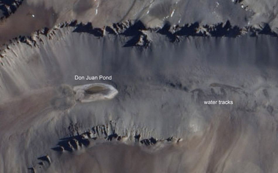
Originally thought to have been formed and given its salinity by groundwater, the pond (it is only around ankle deep, about 300m long and 100m wide, though varies in size) has been shown to be formed from atmospheric water and small amounts of snow melt. The pond forms due to water being sucked out the air by a process known as deliquescence. Salts in the surrounding soils near the surface absorb any water present in the air or soil from any melting that may happen, this water then dissolves the salts that move downhill with the water to the pond, the water then evaporates so concentrating the salts. 90% of Don Juan Pond's salinity comes from calcium chloride (CaCl2) rather than sodium chloride (NaCl) like the world's oceans.
The picture shows Don Juan Pond to the left surrounded by a salt crust, to the right can be seen some dark snake-like tracks that is water starting to flow towards the pond carrying more dissolved salts.
Labyrinth
The Dry Valleys expose the bedrock of Antarctica and with little erosion taking place and no covering of plants, geological features are preserved and are often clearly on view. One of the largest and clearest of such features here is a region known as the "labyrinth". It consists of a series of channels around 50km in all, carved into a 300m thick layer of bedrock.
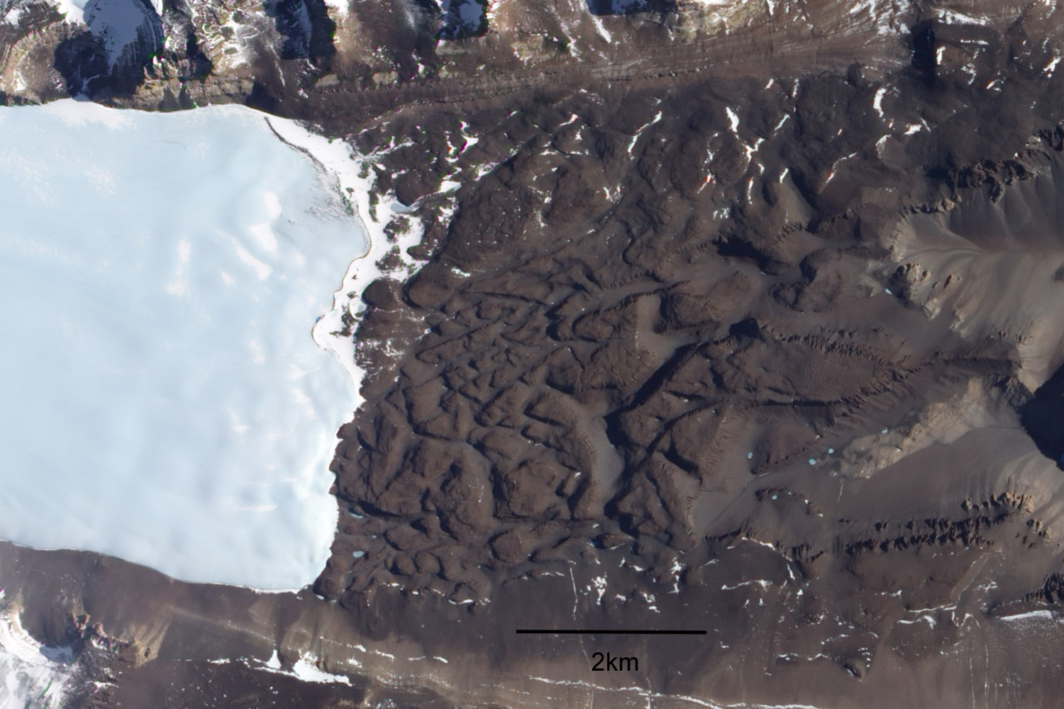
These channels are 600m wide and 250m deep at their largest, they are significant valleys if somewhat dwarfed by the size of the mountains and landscape around them.
The top of the rock that makes up the labyrinth show striations (lines) that indicate a glacier flowing over them at one time. There are potholes at some junctions of channels that are up to 35m deep and reverse gradients, parts that up go uphill against the general downhill trend. These features indicate that at some time very fast flowing glacial meltwater in huge quantities passed through. The date of the latest flow (there may have been several) has been dated at between 14.4 and 12.4 million years ago. The channels of the labyrinth are thought most likely to have been eroded by the episodic drainage of huge lakes that lie under the East Antarctica Ice Sheet.
The volume of fresh water that would have been released into the Ross Sea by such an event would have disrupted ocean circulation and contributed to regional and global climate changes.
Lakes
Another counter intuitive finding in the Dry Valleys is a series of more than 20 permanent lakes and ponds. A number of these are extremely saline or in the case of the larger and deeper ones are strongly layered by depth becoming more saline the deeper you go, the most extreme of them all is Don Juan Pond described above which is the only one that doesn't freeze at the surface.
 Lake
Fryxell one of the larger lakes in Taylor Valley, it
is fed by summer meltwater that comes from the Canada Glacier
seen behind the lake. There are other lakes that form on the
other side of this glacier in the same way.
Lake
Fryxell one of the larger lakes in Taylor Valley, it
is fed by summer meltwater that comes from the Canada Glacier
seen behind the lake. There are other lakes that form on the
other side of this glacier in the same way.
Some of the lakes are quite small and freeze right down to the bottom in the winter. Lake Vanda is one of the largest at 5.6 km x 1.5 km at the extremes, with a depth of 68.8 m, it has a smooth permanent ice cover around 4 m thick, in the summer a moat develops as the shore ice melts. These lakes usually get most of their water by summer melting from nearby glaciers. Once formed, a balance between water entering occurs with ice sublimation from the surface leading to a fairly stable size.
As there is little or no snowfall in the Dry Valleys the ice on the surface of the lakes is exposed and can be quite beautiful, very hard and clear blue ice often with inclusions of small air bubbles. The water in the lakes often contains a microbial ecosystem powered by the sunlight that reaches through the hard clear ice.
In recent years a series of underground interconnected lakes have also been found along with brine saturated sediments.
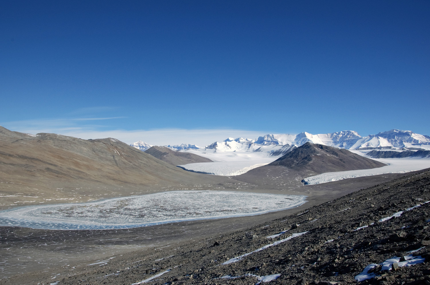
Miers Valley and Lake Miers
Picture credits: Miers Valley - Saxphile - Creative Commons Attribution 3.0 Unported License / Mummified Seals - Mike Usher and Kristan Hutchison, National Science Foundation / Aerial pictures - NASA / Blood Falls closer picture DepositPhotos