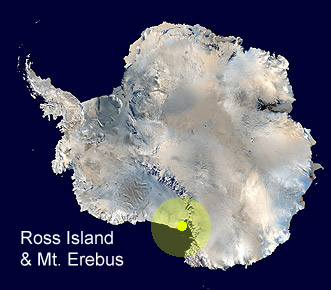
 Ross
Island and Mount Erebus
Ross
Island and Mount Erebus
Antarctic
Regions - Maps and Pictures
Regional maps of Antarctica with photographs of the area.
Geography - map skills
Teacher file, maps + worksheet + answers
word document
| pdf document
A high resolution zoomable map of Antarctica
here
Another zoomable Antarctic map, not quite so high
resolution but more visible features
here
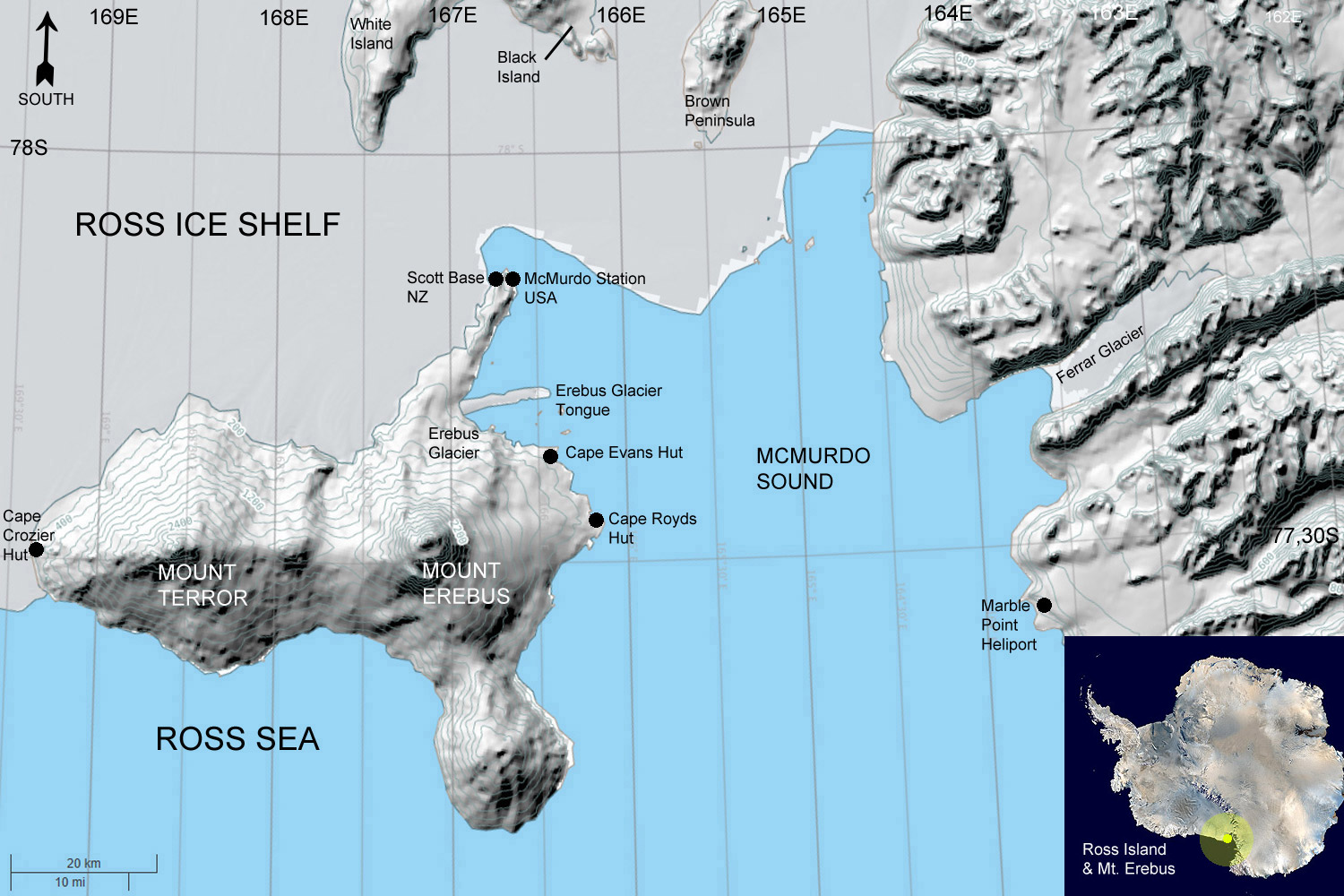
An entirely volcanic island in the Ross Sea off the coast of Antarctica in McMurdo Sound at 77°30'S 168°00'E, Ross Island is made up of four volcanoes including Mount Erebus, the worlds most southerly active volcano 3,794m (12,448ft) high and one of a very few worldwide with a permanent lava lake in the crater. Ross Island gives the impression of being part of the mainland as there is a permanent ice connection to the Ross Ice Shelf along the southern edge.
Ross Island was discovered by Sir James Clark Ross in 1841 and was thought to be part of the mainland. It was found to be an island by the British National Antarctic Expedition in 1901-04 and named for Ross by Captain Scott. Mount Erebus was named by Ross for his ship. The extinct volcano Mount Terror on Ross Island was named for Ross's other ship on his expedition at the time.
Ross Island
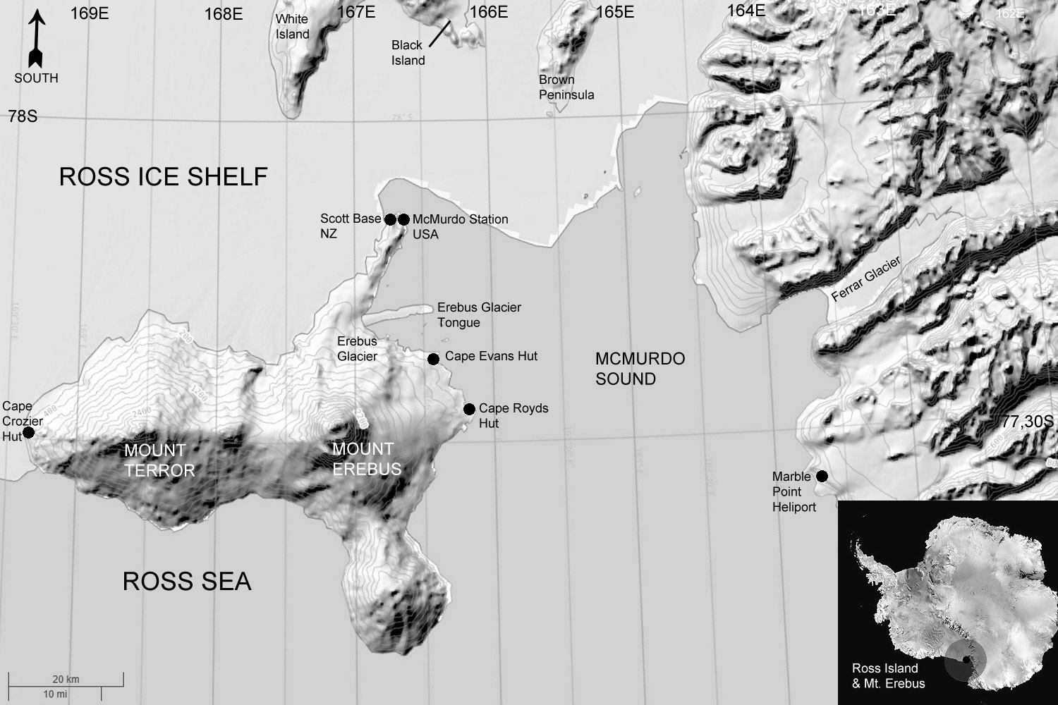
Black and white to print and photocopy
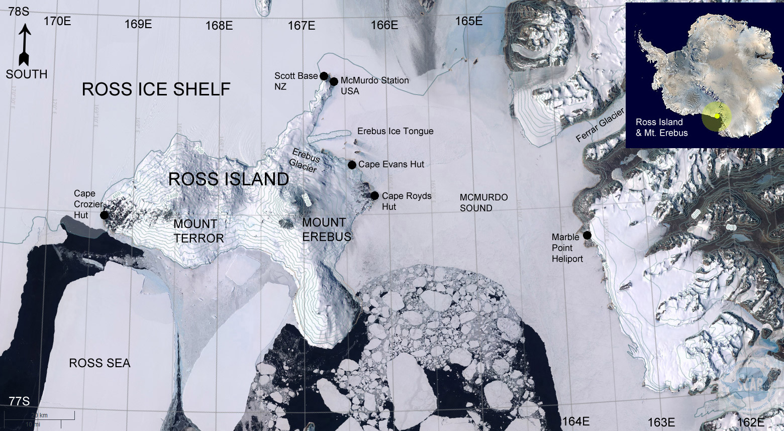
Ross Island, satellite view

Satellite view, black and white to print and photocopy
Ross Island has played a large role in the history and
exploration of Antarctica. It has three historic huts that were
built and used by the explorers Scott and Shackleton in the
Heroic Age of Antarctic Exploration from 1898 to 1922.
There are two currently active scientific stations at the end of the Hut Point Peninsula, the American McMurdo Station which was established in 1956 and the New Zealand Scott Base established in 1957.
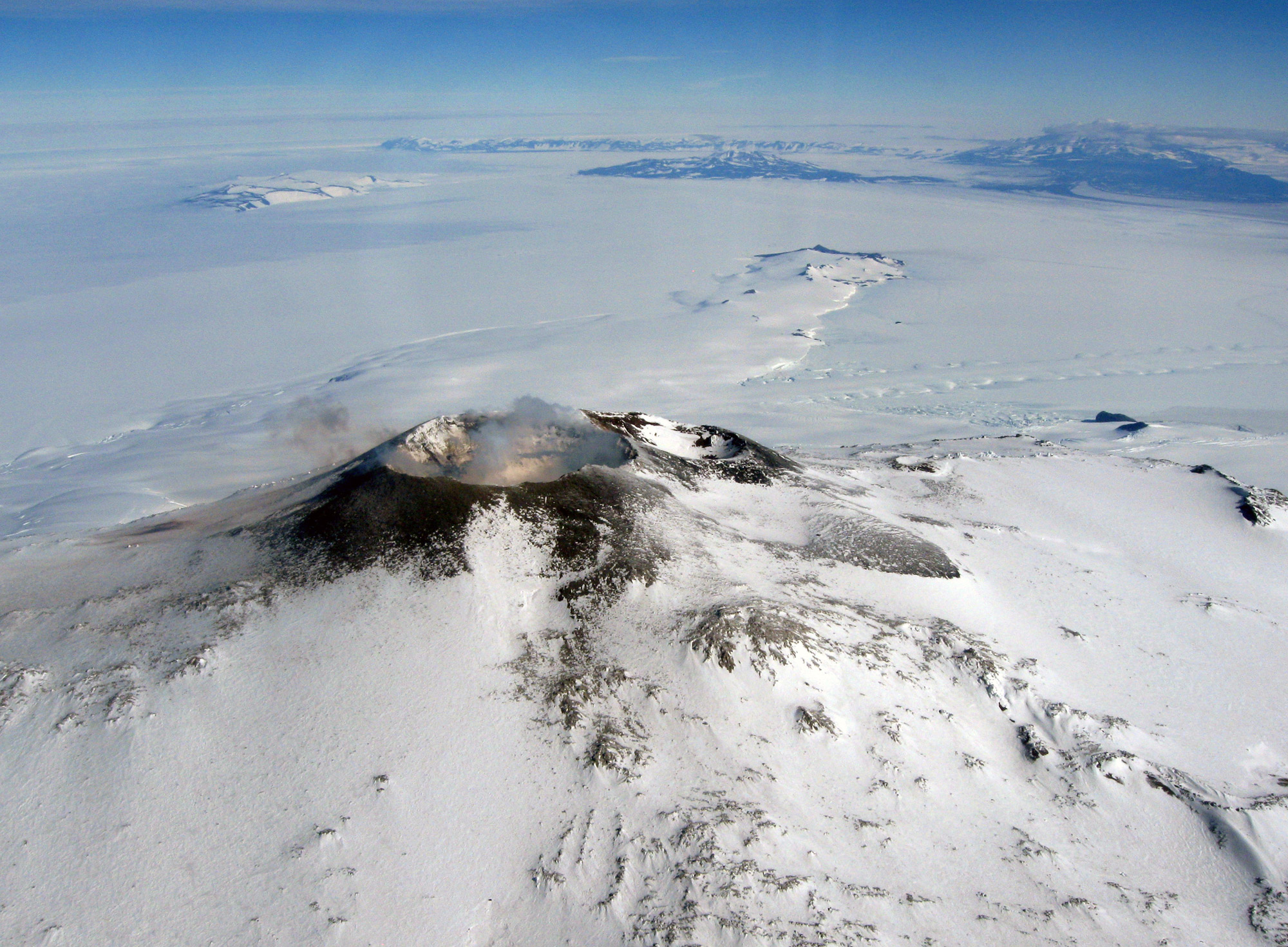
Mount Erebus summit crater looking out to the Hut Point Peninsula and Erebus Ice Tongue with islands and the mainland in the distance.
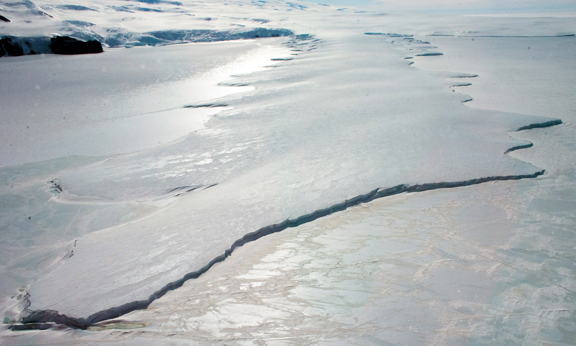
The Erebus Ice Tongue looking towards the Erebus Glacier and Ross Island.
An ice tongue forms where a valley glacier moves quickly
out to sea, the ice is freshwater ice fed in this case by accumulated
snow from the slopes of Mount Erebus which floats when it meets
the sea.
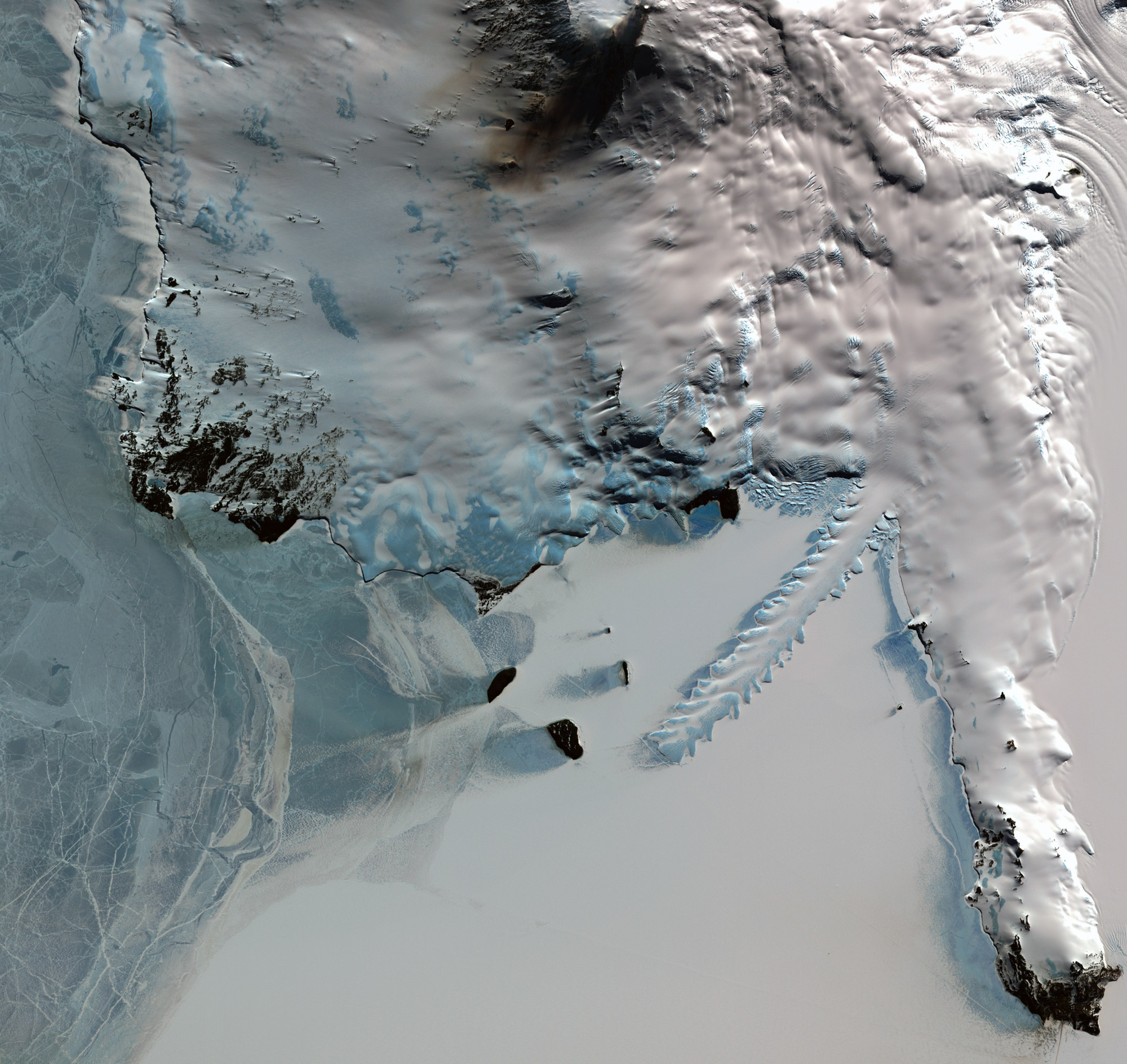
Satellite view of the Hut Point Peninsula, Erebus Glacier and Ice Tongue with Mount Erebus to the top. NASA
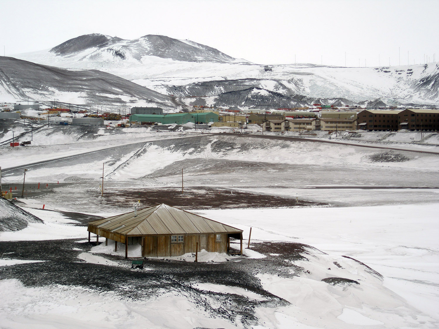
Captains Scott's Discovery Hut built for his 1901-04 expedition with McMurdo Station (USA), established 1956, in the background.
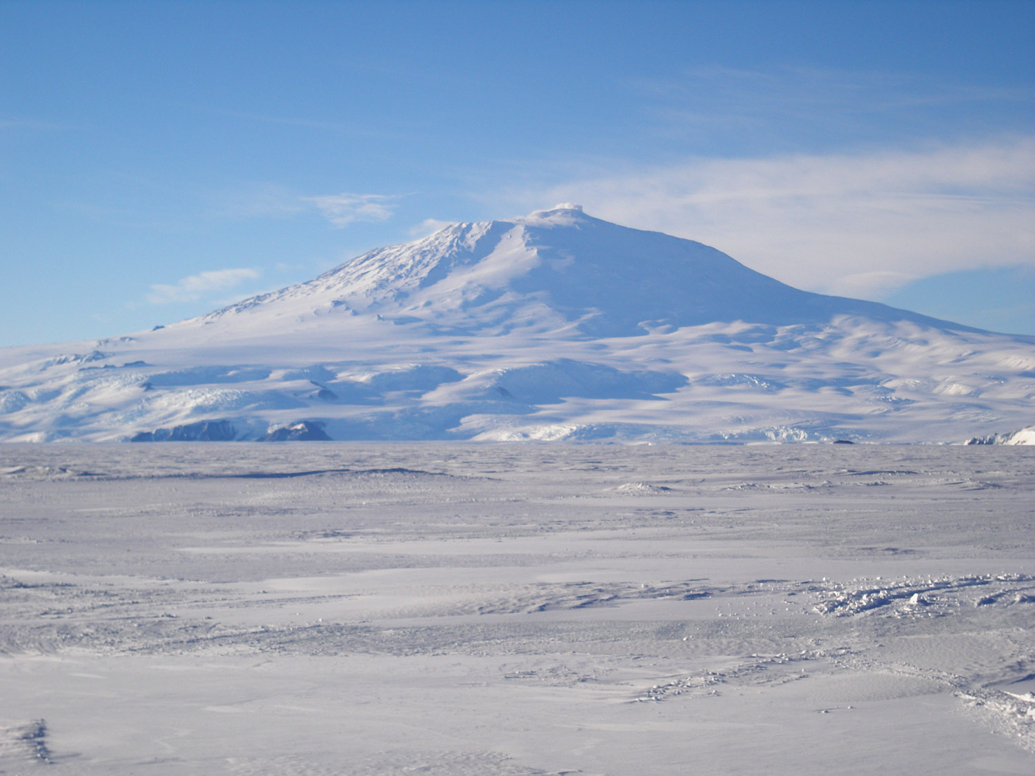
Mount Erebus from the sea ice.
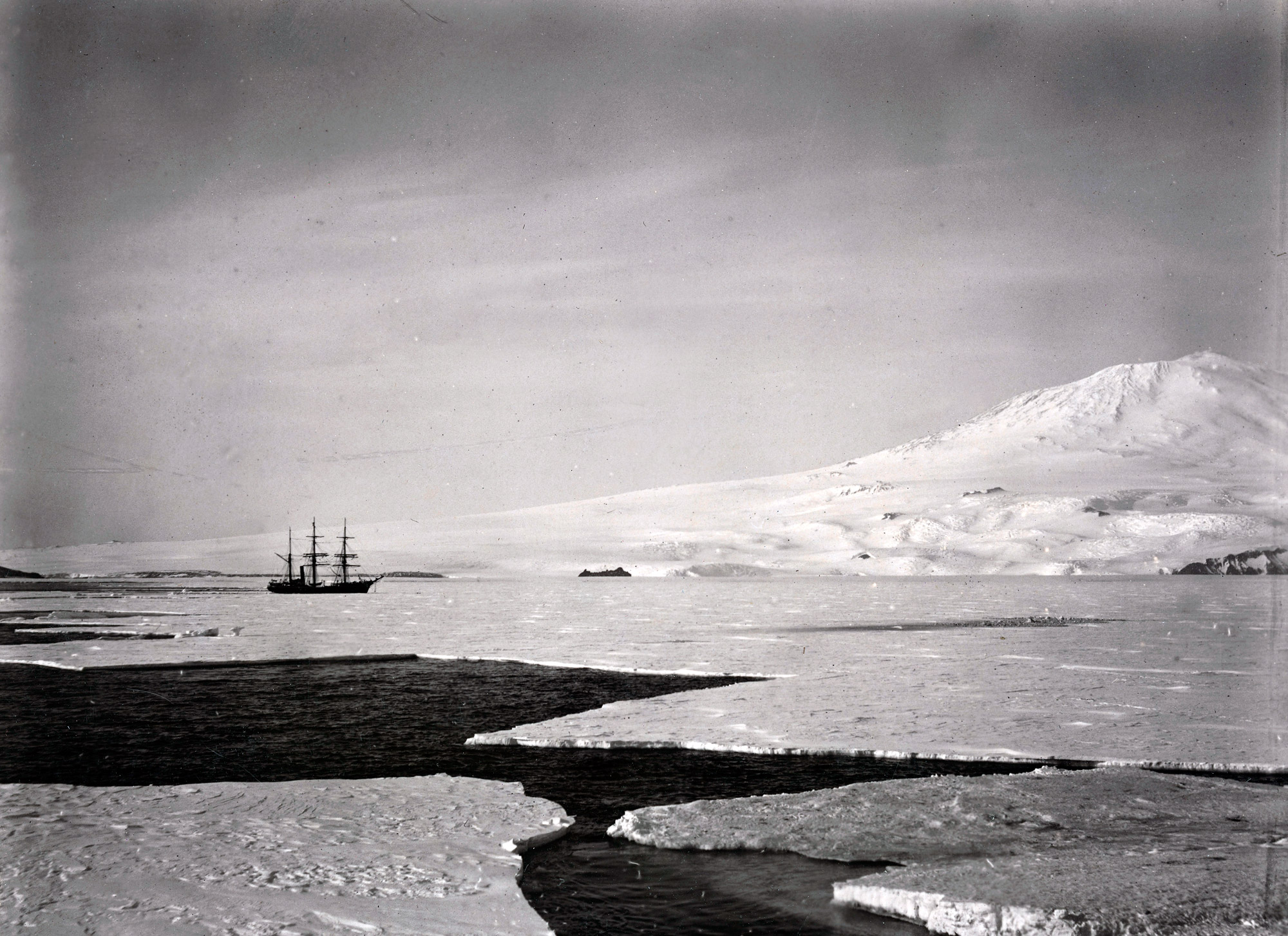
RRS Discovery and Mount Erebus on the British National Antarctic Expedition with Captain Scott, 1901-04.
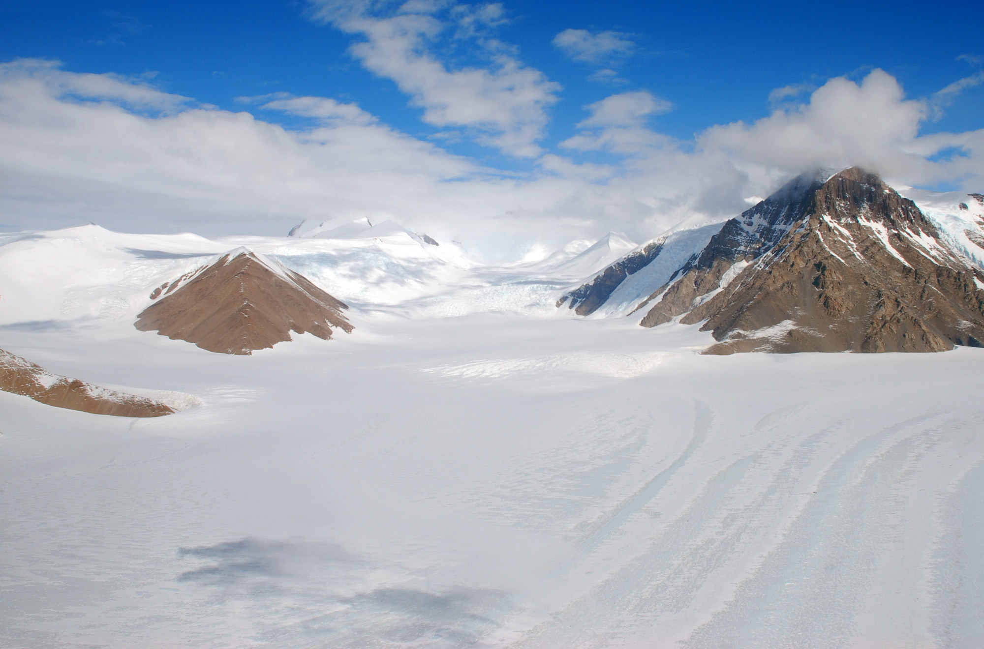
The Ferrar Glacier on the mainland near to Ross Island
this glacier discharges into McMurdo Sound
Source of the Maps
Antarctic
Digital Database Map Viewer - License terms and conditions
- Data is licensed according to Creative Commons CC-BY - data
is free to use, modify and redistribute provided the source
"SCAR Antarctic Digital Database" is acknowledged, and that
the disclaimer below is accepted.
Disclaimer - Information
in the Antarctic Digital Database has been obtained from sources
believed to be reliable but its accuracy and completeness, and
the validity of the opinions based thereon, are not guaranteed.
As every effort has been made to provide accurate information
in this database, SCAR would appreciate it if users could indicate
in writing any errors that may be noticed. SCAR is not inviting
reliance on these data, and the user should always check original
published data. The information in this database is subject
to change. Questions about the data should be addressed to Adrian
Fox
https://add.data.bas.ac.uk/repository/entry/show?entryid=f477219b-9121-44d6-afa6-d8552762dc45
Picture credits: Erebus crater by Nick Powell - NSF / Erebus Ice Tongue by Mike Lucibella - NSF / Scott's Hut and Erebus from sea ice by Alan Light / Ferrar Glacier- Elaine-Hood - NSF.